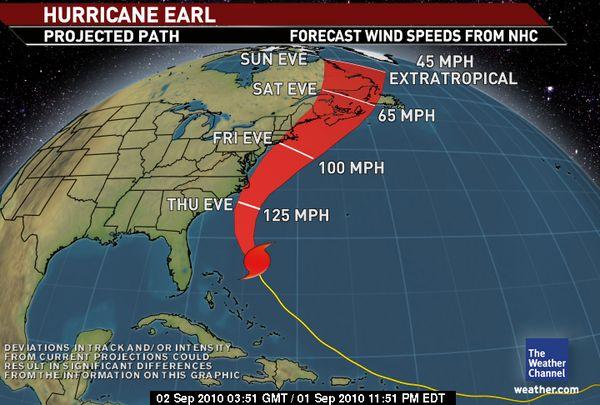
| As of 11 pm EDT Wednesday Hurricane Earl was located about 520 miles south-southeast of Cape Hatteras, North Carolina with top winds near 140 mph. Earl is moving toward the north-northwest at 18 mph. It is expected to gradually turn to the north tomorrow.
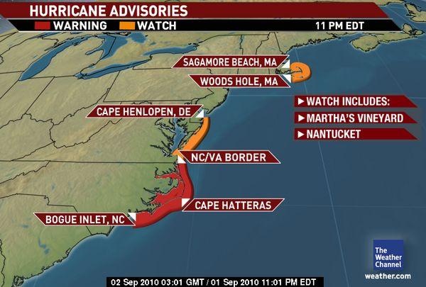
A hurricane warning is in effect for Bogue Inlet, NC northeastward to the NC/VA border, including the Pamlico and Abermarle Sounds. A hurricane watch is in effect for north of the NC/VA border to Cape Henlopen, DE and from Woods Hole to Sagamore Beach, MA, including Martha's Vineyard and Nantucket.
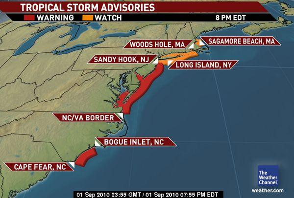
A tropical storm warning is in effect from Cape Fear to west of Bogue Inlet, NC and from the NC/VA border to Sandy Hook, NJ, including Delaware Bay south of Slaughter Beach and the Chesapeake Bay south of New Port Comfort.
Squally showers, gusty winds and dangerous waves will start affecting the coastal areas of Virginia late Thrusday night, then Delaware, New Jersey and coastal New York Friday and southern New England Friday evening. On Saturday Earl will move over the Canadian Maritimes provinces.
Ridge VFD will update this story as conditions change.
For tips on preparing for the storm, read our online story:
http://www.ridgevfd.org/index.cfm?fs=managenews.preview&News_ID=360
Photos courtesy of The Weather Channel. |