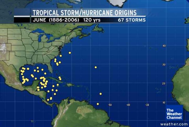
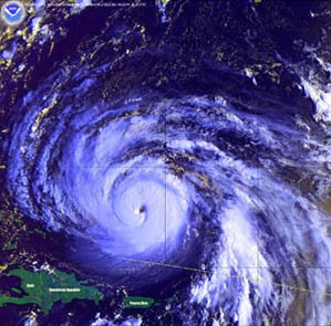
| The 2007 Atlantic hurricane season got off to an early start with Subtropical Storm Andrea forming in early May. It impacted the East Coast from North Carolina to Florida with high waves, beach erosion and strong winds, but overall, little rain for the drought-stricken Southeast. The Hurricane Season typically runs from June to November.
In any given year, historically, the chance of being hit directly by a hurricane of any scale is not very high. In fact, the chances of Southern Maryland and the immediate surrounding area having the eye of a land-falling hurricane pass within 50 miles of any point is less than 8%. Recent history has tried to prove otherwise, however, this statistic should make you feel a little more at ease.
The National Oceanic and Atmospheric Association (NOAA) announced its outlook for a "high probability" of an above average season. NOAA predicts 13-17 named storms, seven to 10 of which will become hurricans, and three to five of those category 3 or higher. The normal average of named storms in the Atlantic, Caribbean, and Gulf of Mexico including both tropical (cyclones) storms and hurricanes is 10. Actual hurricanes (winds greater than 74 m.p.h.) make up about 6 of these, and on average just 2 of these reach Category 3 or higher (winds greater than 111 m.p.h.) on the Saffir-Simpson scale. The past decade and a half has proven to be slightly more active than the previous 10 years, and this trend is likely to continue for a few more years.
Some things to consider as we push through the season:
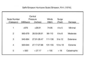
1. Read and understand the Saffir-Simpson Hurricane Scale, it is very specific as to the kinds of damage commonly witnessed in hurricane related events. Go to: http://www.nhc.noaa.gov/ and click on Saffir-Simpson Scale, (left-hand column), or check the attachement below. Also, read the sections under hurricane preparedness, they are very informative.
2. Remember, just because a hurricane may be making landfall as something considered less than a major hurricane (Cat 1-3) by no means mean you are in the clear. In 1999, Hurricane Floyd came
ashore as a Cat 2 dropping tons of rain and causing massive flooding all along the east coast, killing 56 people.
3. Pay close attention to developing systems, take them seriously 1 week out. At the very least, pack necessary survival items in the car to include all your important documents; i.e., birth and marriage certificates and insurance stuff. Do not wait until the last minute! A little attention and preparedness will go a long way.
4. The reality of hurricane intensity is often unknown until landfall. Keep an eye on the storms central pressure, and look at the storm via visible or water vapor imagery. This provides the best means for the arm-chair forecaster for judging hurricane characteristics without any real proof.
5. Most importantly, prepare a Family Disaster Plan, which includes:
- Discuss the type of hazards that could affect your family. Know your home's vulnerability to storm surge, flooding and wind.
- Locate a safe room or the safest areas in your home for each hurricane hazard. In certain circumstances the safest areas may not be your home, but within your community.
- Determine escape routes from your home and places to meet.
- Have an out-of-state friend as a family contact, so all your family members have a single point of contact.
- Make a plan now for what to do with your pets if you need to evacuate.
- Post emergency telephone numbers by your phones and make sure your children know how and when to call 911.
- Check your insurance coverage - flood damage is not usually covered by homeowners insurance.
- Stock non-perishable emergency supplies and a Disaster Supply Kit, which should include:
- Water - at least 1 gallon daily per person for 3 to 7 days
- Food - at least enough for 3 to 7 days
- Non-perishable packaged or canned food / juices
- Non-electric can opener
- Cooking tools / fuel / paper plates / plastic utensils
- Blankets / Pillows, etc.
- Clothing - seasonal / rain gear/ sturdy shoes
- First Aid Kit / Medicines / Prescription Drugs
- Toiletries / Hygiene items / Moisture wipes
- Flashlight / Batteries
- Radio - Battery operated and NOAA weather radio
- Cash - Banks and ATMs may not be open or available for extended periods.
- Keys
- Toys, Books and Games
- Important documents - in a waterproof container (e.g., insurance, medical records, bank account numbers, Social Security card, etc.)
- Tools - keep a set with you during the storm
- Vehicle fuel tanks filled
- Pet care items (ID / immunization records / medications, food & water, carrier or cage, muzzle & leash)
- Remember to replace radio batteries every 6 months, as you do with your smoke detectors.
- Click here http://www.coderedweb.com/codereddataentry/index.cfm?GroupID=1068 to be notified by your local emergency response team in the event of emergency situations or critical community alerts.
ADDITIONAL SAFETY INFORMATION
WATCH vs. WARNING - KNOW THE DIFFERENCE
- A HURRICANE WATCH issued for your part of the coast indicates the possibility that you could experience hurricane conditions within 36 hours. This watch should trigger your family's disaster plan, and protective measures should be initiated, especially those actions that require extra time such as securing a boat, leaving a barrier island, etc.
- A HURRICANE WARNING issued for your part of the coast indicates that sustained winds of at least 74 mph are expected within 24 hours or less. Once this warning has been issued, your family should be in the process of completing protective actions and deciding the safest location to be during the storm.
2007 Atlantic Storm Names
Andrea
Barry
Chantal
Dean
Erin
Felix
Gabrielle
Humberto
Ingrid
Jerry
Karen
Lorenzo
Melissa
Noel
Olga
Pablo
Rebekah
Sebastien
Tanya
Van |