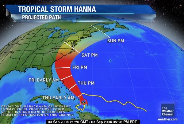
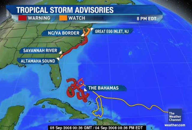
| According to The Weather Channel, Tropical Storm Hanna may soon increase to Hurricane strength. They are currently projecting the path of Hanna to skirt the U.S. Eastern Coast, with impact to the Maryland area by Saturday, September 6th. The following story is courtesy of The Weather Channel (www.weather.com).
Tropical Storm Hanna is showing signs of organization and strengthening this afternoon. Although top sustained winds are holding steady at 60 mph, Hanna's pressure has dropped several millibars. Surface winds may respond in time to that lowering of pressure.
Although Hanna's top winds have leveled off for the time being, it has, however, expanded greatly in overall size. Tropical storm-force winds now extend 290 miles north of the center of circulation.
Further organization and strengthening of Hanna is anticipated tonight or tomorrow. It also may regain hurricane status sometime Thursday (Sept 4) into Friday (Sept 5).
After heading south yesterday, Tropical Storm Hanna is now heading to the north at a faster pace at 12 mph. Additional increase in forward speed is likely. Hanna will move through all of the Bahamas tonight and Thursday.
Drenching, deadly rains have been occurring over Hispaniola and the southeastern Bahamas because of Hanna. Flooding rains have already occurred over the Dominican Republic but especially over Haiti which is still recovering from Fay and Gustav's rains. Reports indicate that Hanna's tremendous rainfall has killed at least 25 people in Haiti due to flooding and mudslides.
The storm has already churned the ocean waters off the Southeast US coast. Earlier this week, numerous rescues by lifeguards were carried out along the beaches of South Carolina, Georgia, and North Carolina all due to the dangerous rip currents. The high rip current threat will last through the remainder of the week.
Coastal residents of South Carolina and North Carolina should monitor the track and development of Hanna. By Friday afternoon, Tropical Storm or perhaps Hurricane Hanna will be nearing the Southeast U.S. coast. The Weather Channel's projected path takes Hanna's center of circulation towards an eventual landfall close to the South Carolina/North Carolina border.
To view the Hanna Tracker, visit: http://www.weather.com/newscenter/hurricanecentral/2008/hanna.html
For tips on preparing for the storm, read our online story:
http://www.ridgevfd.org/index.cfm?fs=news.newsView&News_ID=278 |